The Client
The Copernicus Marine Service, through its user engagement programme.
Partners
The costal service proposed is developed by Marine Institute and NOW Systems.
The Challenge
The primary goal of the BIODIVER-COAST Service is to provide timely and relevant information on environmental conditions to support sustainable and ecologically responsible acquaculture, as well as the preservation of biodiversity in the Galway Bay.
Galway Bay hosts some of the last remaining populations of native oyster in Ireland, along with multitude of bivalve mariculture production sites. To support sustainable acuqulture, it is essential to provide timely information on unfavorable environmental conditions, enabling farmers to take preventive actions to protect their stocks. Among others, one of the major concerns is the low salinity events, which significantly increase bivalve mortality.
The coastal pilot service, currently being developed as part of the BIODIVER-COAST project series (Phases 1 & 2), will utilize model data from the Marine Institute’s coastal modeling system, along with near real-time in-situ observational data.
The BIODIVER-COAST Service, accesible through a NAUI online platform (biodiver.naui.io) developed by NOW Systems, provides a fit-for-purpose early warning system for environmental risks (i.e., low salinity events and Marine Heat waves, etc.). The system integrates monitoring and forecasting data, and has been co-designed with local end users (including NGO Cuan Beo and the Irish Environmental Protection Agency). For example, threshold values that trigger alerts are defined based on a combination of oyster farmers’ local knowledge, laboratory experiments -where oysters are exposed to varying salinities and temperatures conditions-, and model hindcast analysis).
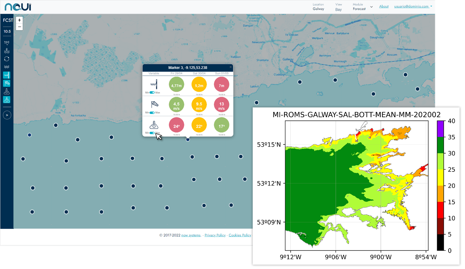
Supporting development of sustainable bivalve aquaculture, native oyster ground restoration and preservation of biodiversity in Galway Bay.
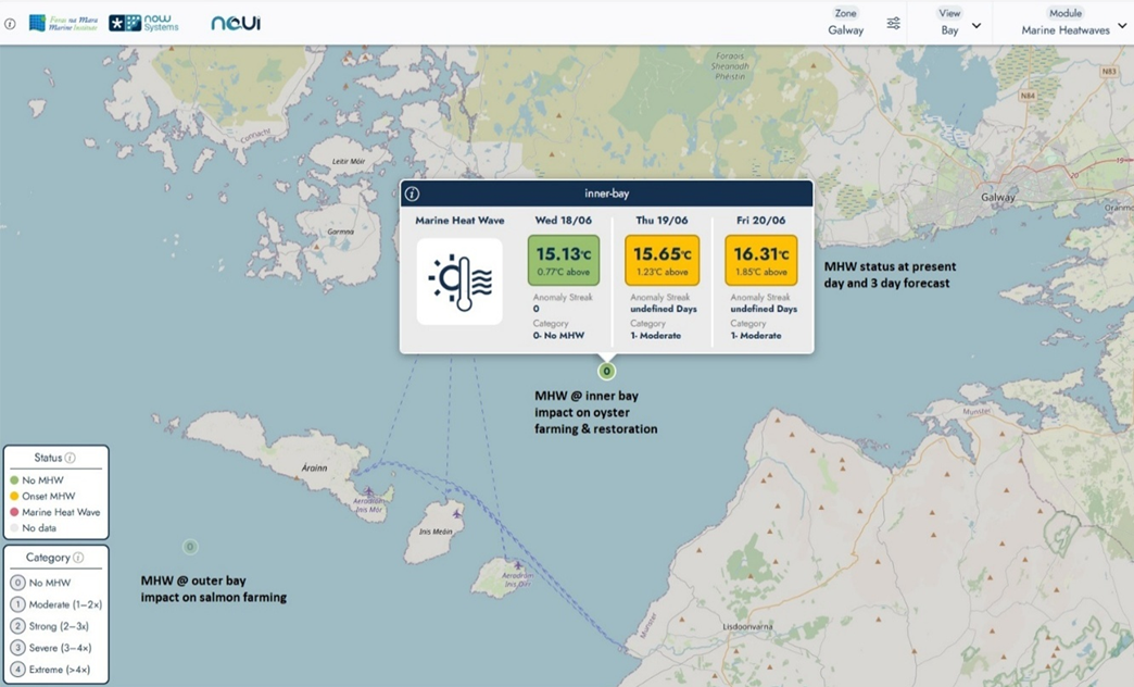
Detecting upcoming abnormally high temperatures (MHWs) that may impact on the health of shellfish and salmon.
The Results
This service will support: Sustainable and ecologically responsible aquaculture and biodiversity preservation, addressing needs of the EU Water Framework Directive (WFD) and OSPAR Strategy, as Nature Based Solution (NBS), helping to achieve water quality targets under WFD.
Copernicus Use Cases
Marine Heatwaves Monitoring in Galway Bay Mapping distribution of suitable habitats for oysters in Galway Bay Low salinity warning system for oyster farming in Galway Bay


