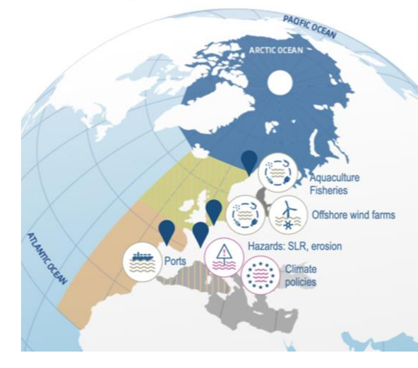
Regions covered in SEACLIM & location of coastal ocean climate services demonstrations and targeted applications (shown with pins)
The Challenge
SEACLIM aims to advancing high-resolution decadal to multidecadal predictions of the marine environment to support climate resilience, ocean governance, and the blue economy.
By downscaling the latest global climate models and integrating them with regional ocean models from Copernicus Marine Service, SEACLIM provides detailed projections on ocean circulation, waves, sea ice, and marine biogeochemistry.
SEACLIM enables pre-operational decadal to multidecadal ocean predictions, developing new regional climate indicators to assess ocean health and coastal hazards. These insights will be integrated into the European Digital Twin of the Ocean, offering data-driven What-if Scenarios for policymakers, businesses, and coastal communities.
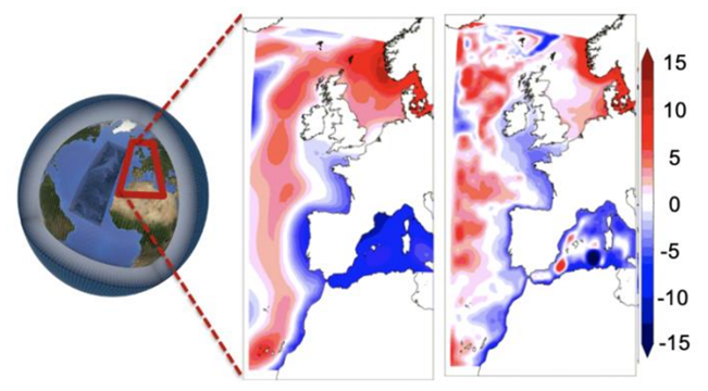
Example of SEACLIM Downscaling of a climate model. Projected changes in dynamic sea level (in cm) from 1986-2005 to 2081-2100 under SSP5-8.5 for CMIP6 CNRM-CM6-1 (1° Ocean resolution) and the SEACLIM downscaling (1/12°)
The Results
NOW Systems within SEACLIM is contributing to:
- Perform the first IBI Decadal Prediction (2025-2035) using model ensembles.
- Design and compute regional climate indicators for the European facade.
- Reach coastal scales, performing AI downscaling for Spanish Ports to support risk assessment, policy making, resiliance, etc.